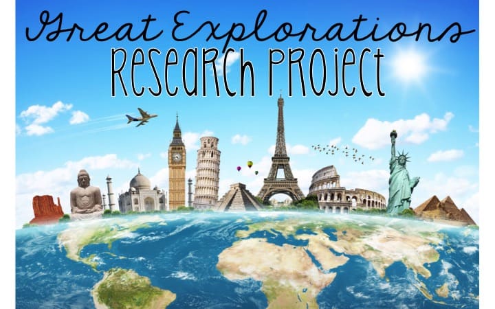
Geography worksheets aren’t always fun, but turn them into stations to make learning geography terms fun! Geography stations can make an often challenging concept or skill fun and meaningful for students. These nine geography stations can be used for a whole group lesson or for centers during social studies. I have to say it was one of the best geography lesson I’ve ever taught! There are two different versions of these geography worksheets: one for GA teachers and one for almost any social studies teacher.
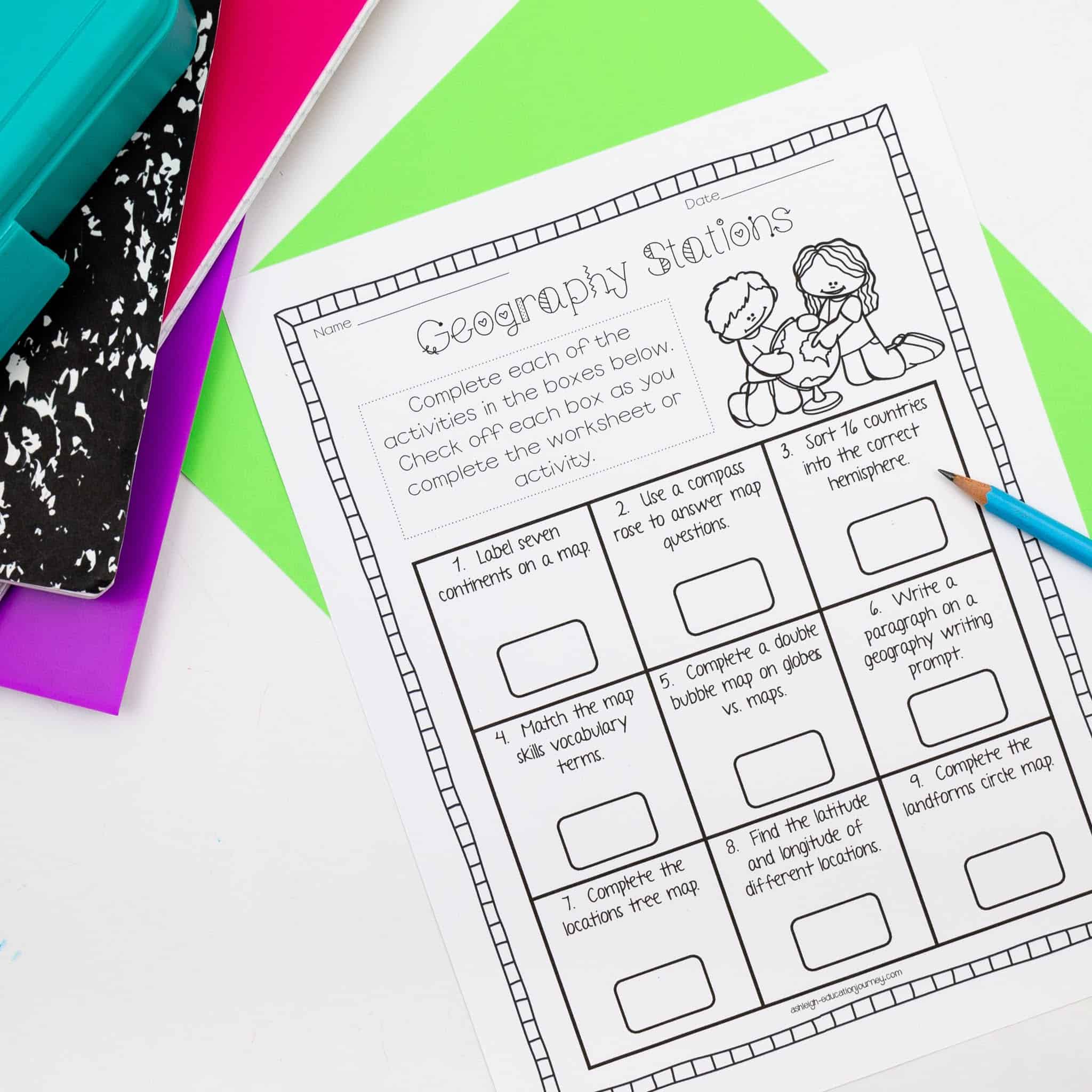
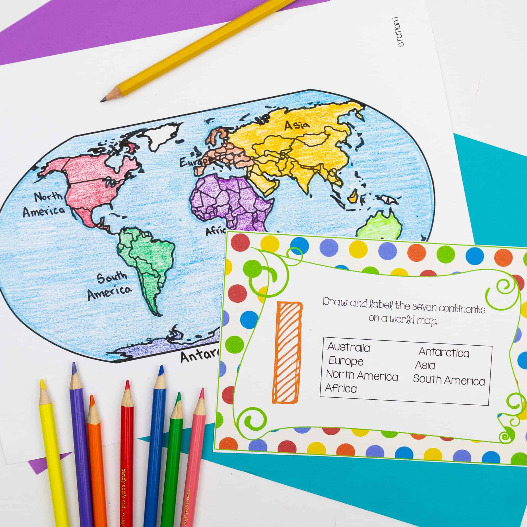
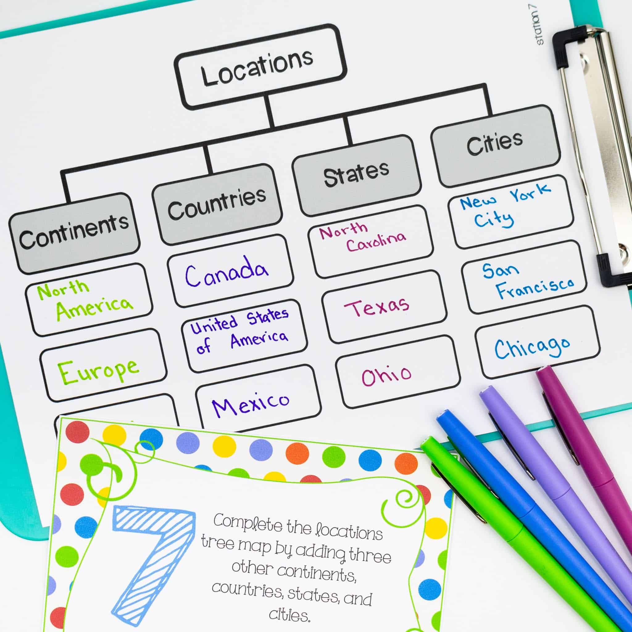
The centers consisted of nine different geography activities that are all listed on the student recording sheet. The recording sheet is completely optional. I like to use it to help students keep track of what stations they have already completed. In Station 1, students draw and label the Rocky and Appalachian Mountains, as well as the Colorado, Rio Grande, Mississippi, Ohio, and Hudson Rivers on a map. The general version has students label the seven continents. This is a great general knowledge geography worksheet and can be used in insolation or with the stations.
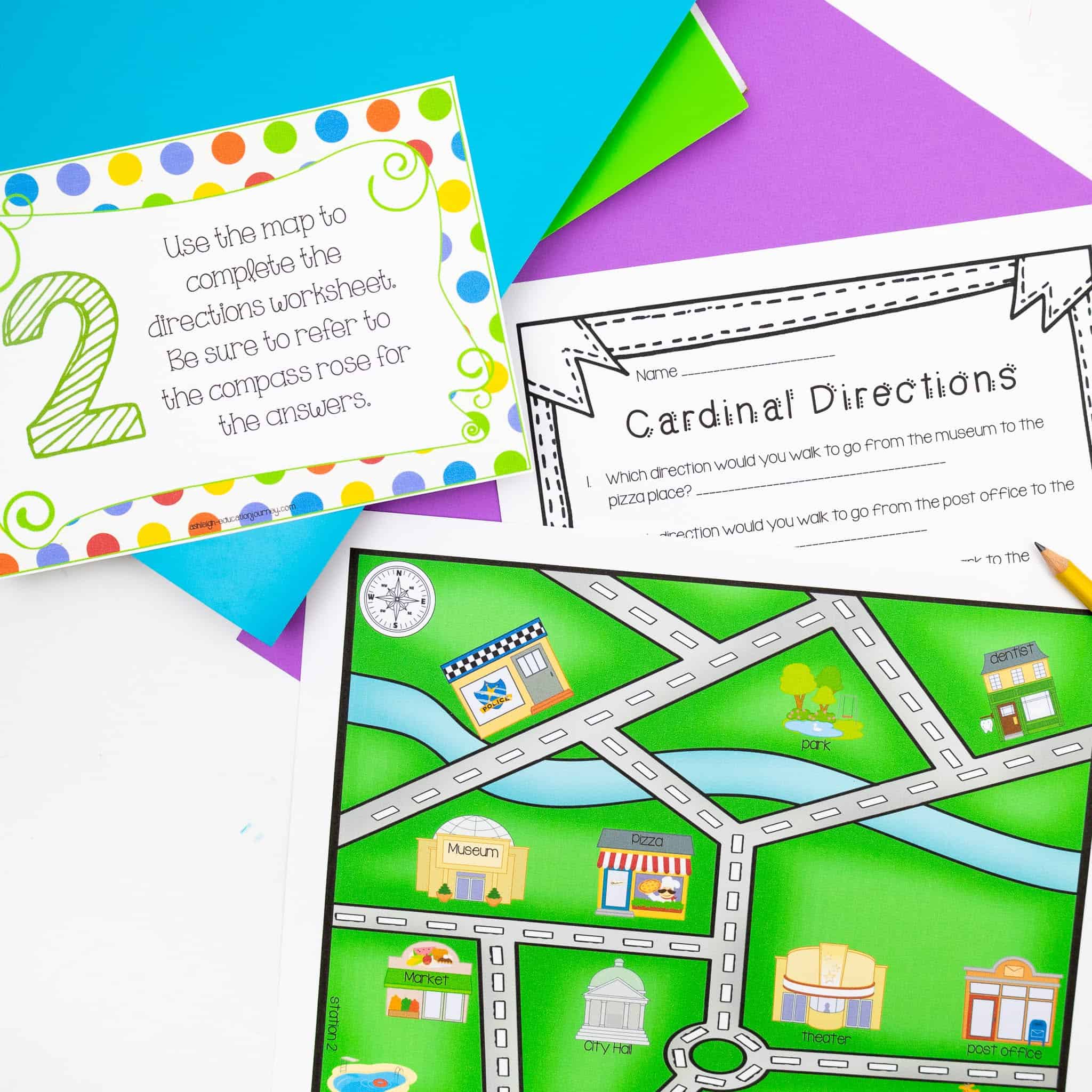
In Station 2, students used a town map to answer cardinal and intermediate directions questions. I’m always surprised to see how challenging this is for my third graders. It seems like it should be easy, but it’s not. I know the green background is heavy on ink, so I also made an ink saving version of the map. I laminate my map, so that I only have to print two copies. This can also be used as an individual geography worksheet, if you prefer not to use the stations.
In Station 3, students find 16 different countries shown on a world map and place them in the correct hemisphere.This allows students to apply what they’ve learned about the four hemispheres, and it gives them further experience reading a map. As with the other activities, this can be part of student geography stations or as an independent geography worksheet.

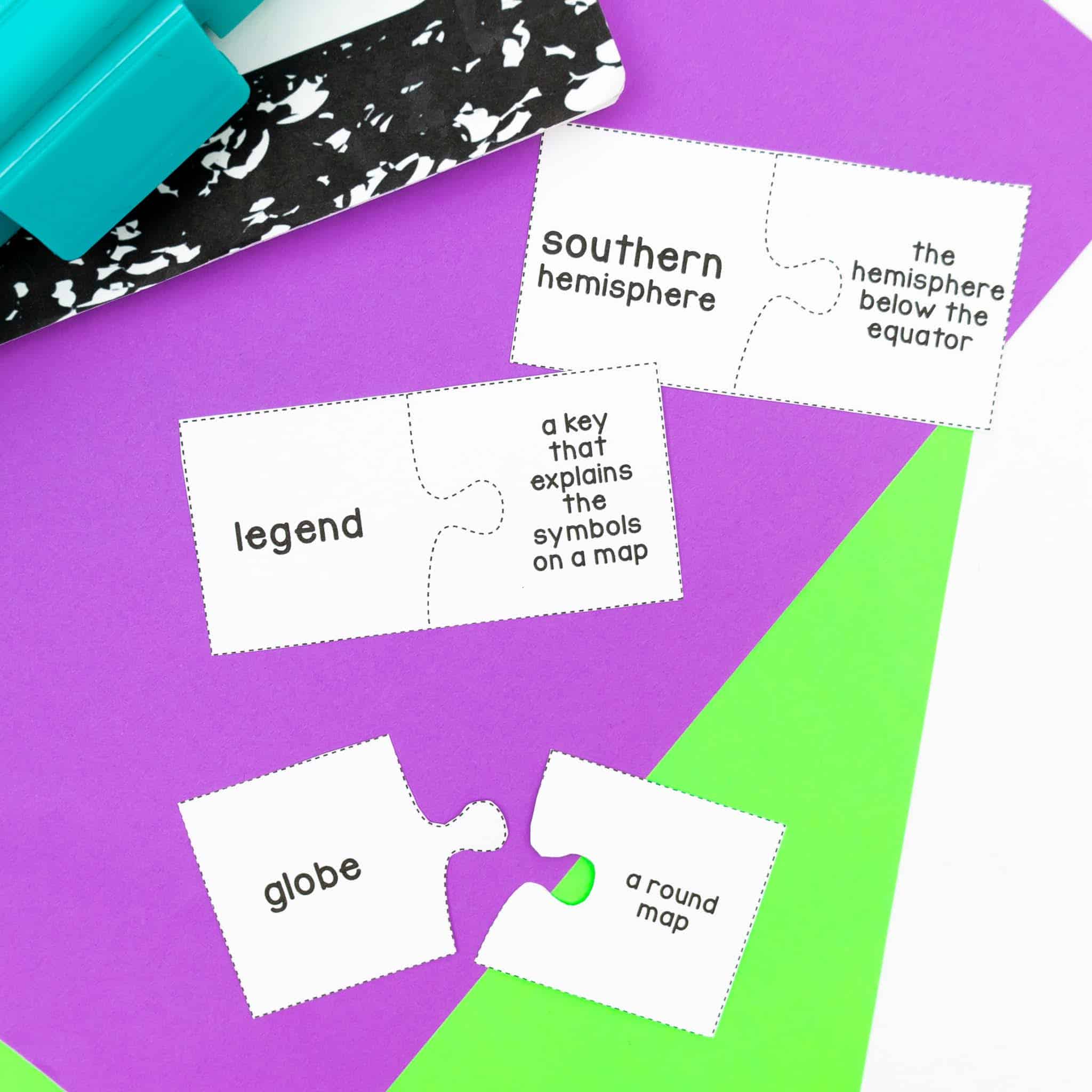
Station 4 had students match geography terms with their correct definition. I print the words on cardstock and laminate the cardstock, so that I can reuse these many times. I included essential vocabulary such as longitude and latitude.
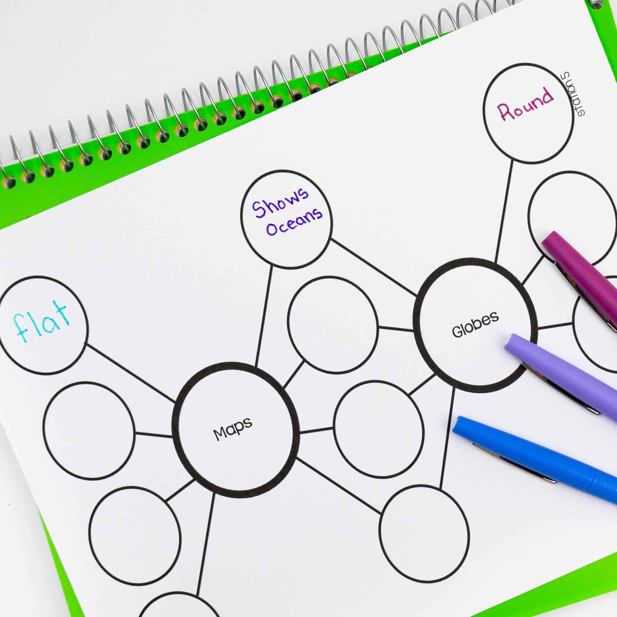
At Station 5, on version of the activities has students compare and contrast the Rocky and Appalachian Mountains. In the other version, students compare and contrast a map and a globe. I love using double bubble maps as an alternative to Venn-diagrams, just because it gives my students a required number of differences and similarities.
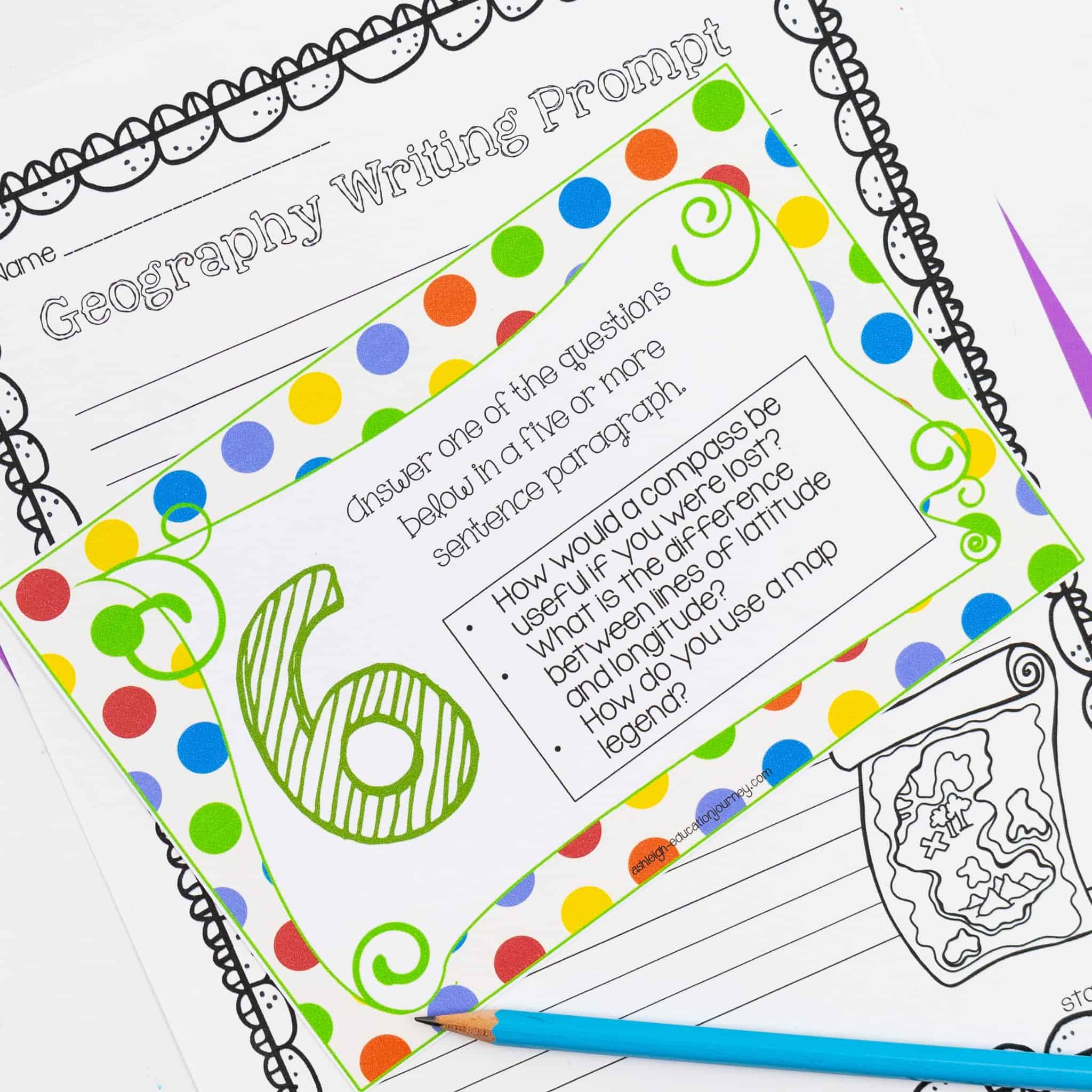
Station 6 had students write a paragraph about one of three writing prompts. Gotta squeeze in that constructed response practice whenever I can! I like that this activity gives students a choice in what to write about, so each student can select a prompt they are comfortable with.
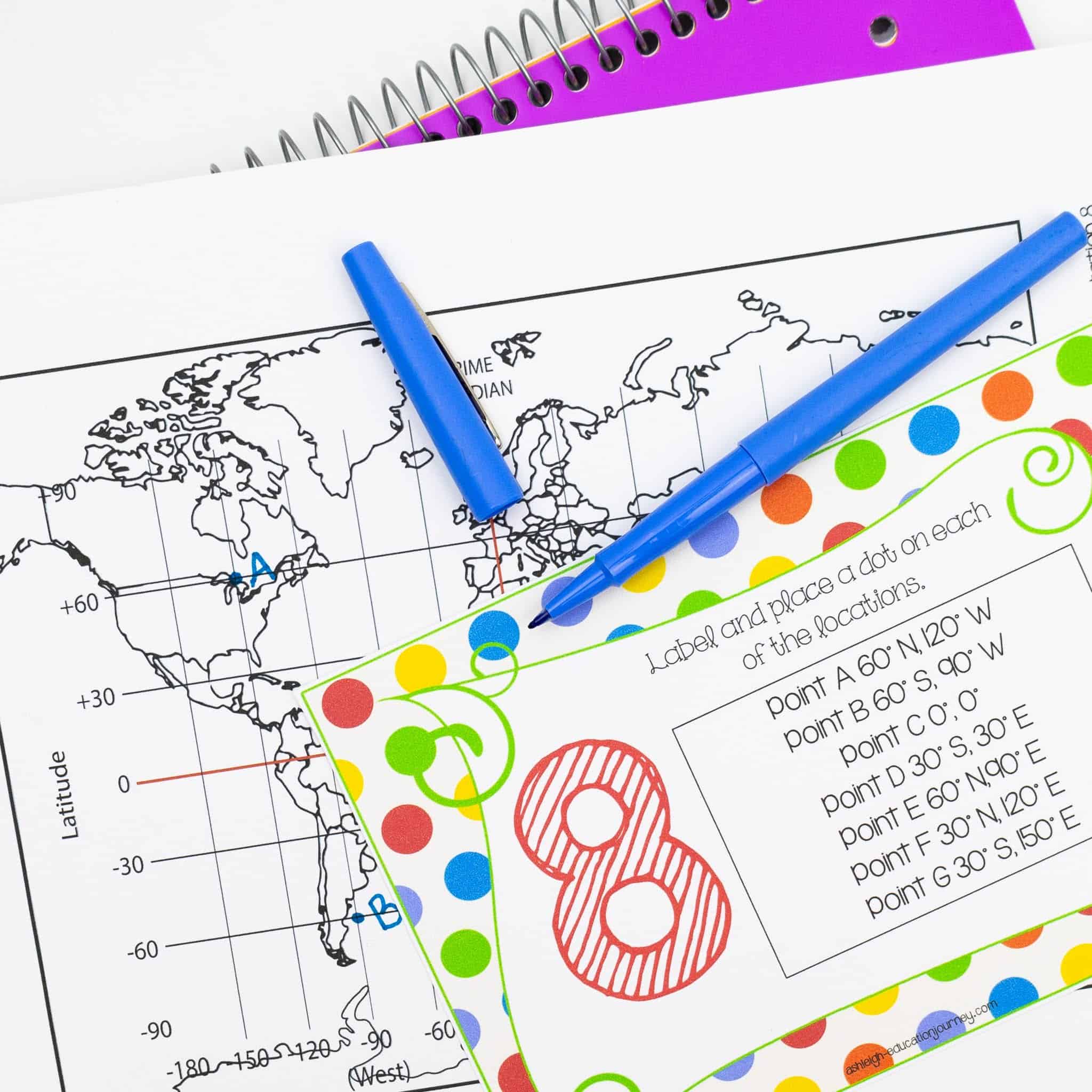
Station 8 gave my students much needed practice on using longitude and latitude, which we can never practice enough longitude and latitude practice. Students find seven different points on a map using longitude and latitude through this geography worksheet.
In Station 9, students complete a circle map using landforms. Students can write descriptions and/or examples and non examples in and out of their circle map.

Hopefully, these social studies centers and geography worksheets and activities will be helpful and give you some ideas as well! If you’d like more ideas on how to teach social studies through engaging activities, be sure to check out this post.